| Start: | Upper Hooper Island |
| End: | Taylor Island Family Campground |
| Estimate Leg: | 12 miles |
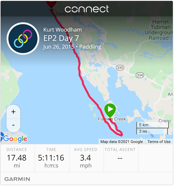
| Actual Leg: | 17.5 miles |
| Estimate Cumulative: | 128 miles |
| Actual Cumulative: | 136.7 miles |
I knew going in that today would be a slow slog against a NW wind. Was not real happy with myself for choosing a take-out for yesterday on the inside shore of upper Hooper Island, and especially one where I would have to paddle out about a mile before I could turn North and make any headway.
Because of my run-in yesterday with rudder-snagging weeds, I decided that I would go another one mile south to the bridge between Upper and Lower Hooper Island and get out into the Bay - hopefully missing the Weeds that seemed to clog the Honga River. So Rather than 12 miles point to point, I had to paddle 2 miles South, and so adding another 2 miles to the distance I had to paddle into the wind. Not my finest logistics moment.
So, per the Garmin track I went a bit over 17 miles in about 5 hours - averaging about 3.5 MPH. Sloooow.
All in all - though, it was a good day. I decided on the front end that I wasn’t going to be frustrated with slow progress, but that I would just enjoy the day and make ground at whatever pace I was able. The NW wind created a pretty good chop, but my boat is great for slicing into the waves and then rising up over them - I just try to time my strokes to bury the blade in the top of the wave. So I really didn’t have to concentrate on paddling so much and could really enjoy the shoreline.
Tomorrow’s forecast looks to be a wash out, and big winds. So it will be my first rest day. I paddled the last seven days, and don’t really have anything sore or strained - which is good. But an enforced rest day will be good. Also, we will be trying to connect with old friends for church on Sunday - so likely not paddling progress for the next couple of days.