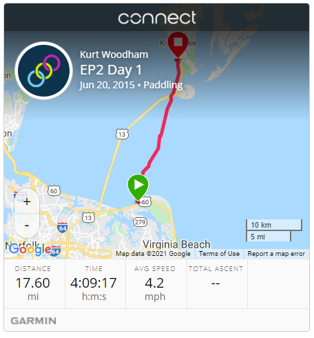
| Start: | First Landing State Park, Virginia Beach, VA |
| End: | Baywood Bed & Breakfast, Cape Charles, VA |
| Estimate Leg: | 18 miles |
| Actual Leg: | 17.6 miles |
| Estimate Cumulative: | 18 miles |
| Actual Cumulative: | 17.6 miles |
Well that was fun!
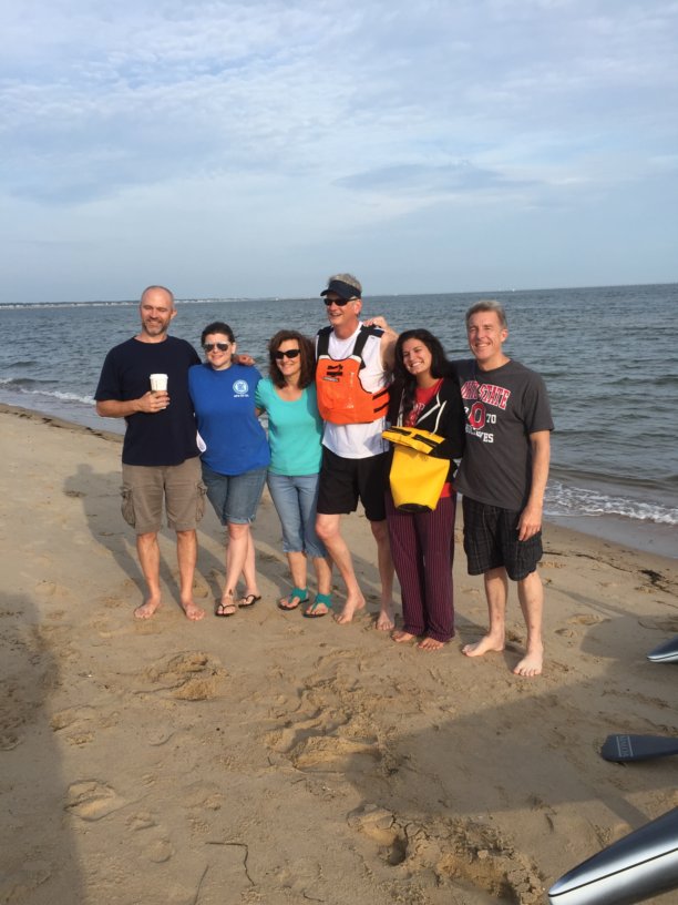
Got away at First Landing right at 7:30 - really appreciated the send-off from friends at church and from “regulars” that I often see at the park who wanted to come see me off.
My original though was to head NW towards the Chesapeake Bay Bridge Tunnel and then follow it across. My intent was that it would provide shelter in case any storms popped up–which was the prediction as of a couple days prior. But Saturday was a beautiful morning, and with a SW wind creating pretty decent chop getting over to the bridge would’ve had me paddling in the troughs of the waves, which is not much fun with the waves coming in broadside right under the ama (outrigger).
So I decided to stay pretty much straight north, using SW swells where I could. Got a couple of pretty decent rides - one clocked on my GPS as close to 8 MPH.
Crossed the Thimble Shoals channel (going into Norfolk) between markers 3 and 4 with no channel traffic at all. Had a couple freighters heading towards me in the Chesapeake Channel but I watched them carefully for a couple minutes and had plenty of time to get across before they came by.
With the push from a few swells here and there, and an incoming tide, I made good time across the mouth of the bay to Fisherman’s Island - was there in three hours. Took another hour to get around the island and up about a mile or so to the B&B.
Got some fresh cold water from my host Mike, and then chilled out for a while with my new friend Luigi the cat while Ruth made her way across the bridge to meet me.