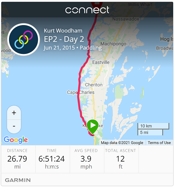
| Start: | Baywood B&B |
| End: | YMCA Silver Beach |
| Estimate Leg: | 25 miles |
| Actual Leg: | 26.8 miles |
| Estimate Cumulative: | 43 miles |
| Actual Cumulative: | 44.4 miles |
Woke up to this:
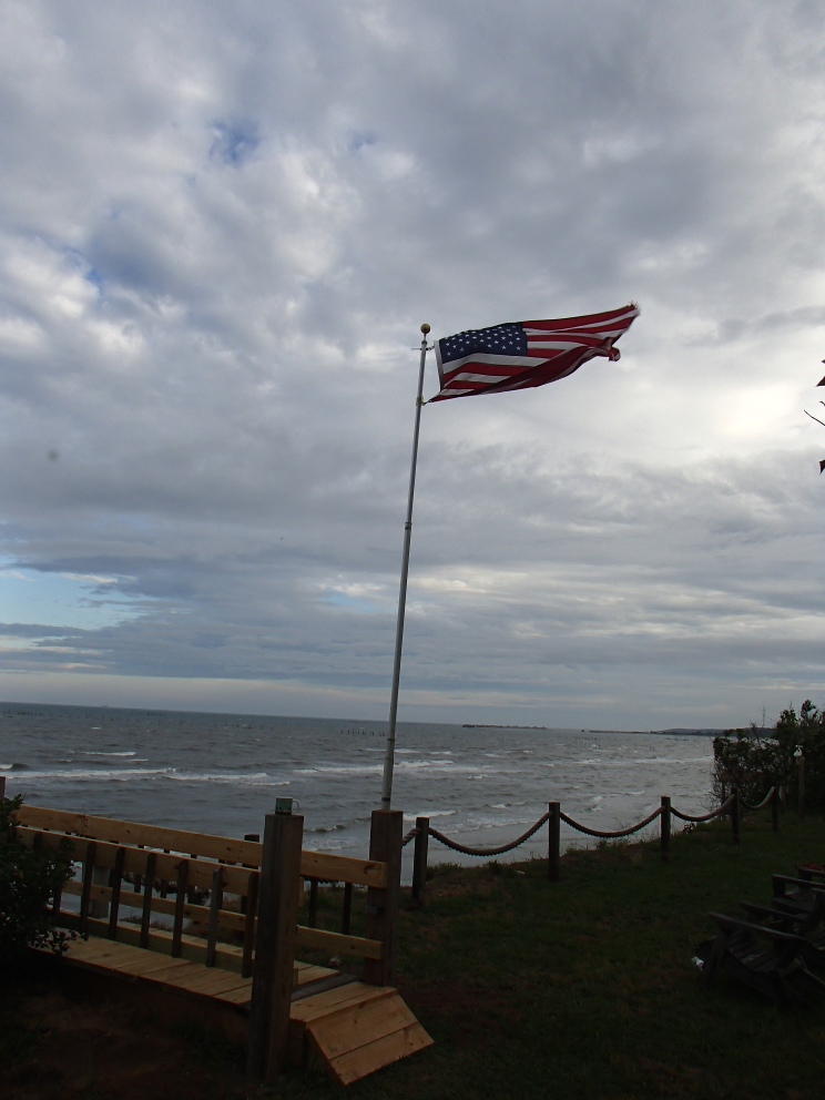
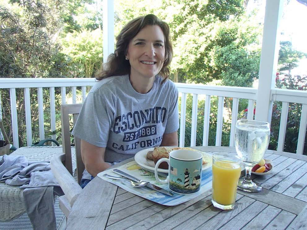
Decided to hold off for a while - fighting this chop coming in under the ama (outrigger) would be a miserable day - waves hitting the rear of the ama lift it up and try to dump me off to the right side (Hawaiian word is “huli” - flip). Fortunately things died down after a while, and the tide was such that paddling through the afternoon would be OK. Plus this is a B&B, and I would be remiss if I did not enjoy the second “B” with my crew.
This was going to be a long one, so I broke it into three legs and made sure that Ruth had good clear spots to come fish me out if I needed to bail early. I had not paddled as far as I had during the bay crossing the day before in a long time, and I wasn’t sure how I would hold up going even further today. First location was Cape Charles beach, right up from where we had been for coffee the day before. The second was a strip of sand that was mostly residences called Smith Beach, which had a open area at the northernmost tip of the strip. The final leg took me to the YMCA camp at Silver Beach, where I had cleared a take-out with the camp host.
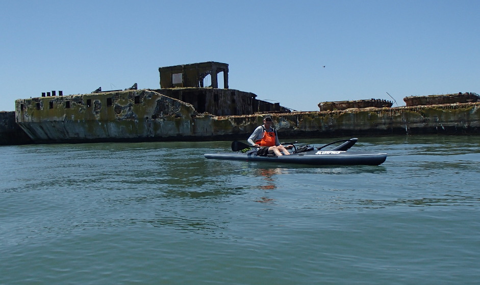
Didn’t start until right around noon and made good time up to Cape Charles. First stop, though, was the concrete boats at Kiptopeke State Park. These boats were sunk in place in 1949 as a breakwater for a ferry line that continued service until the opening of the Chesapeake Bay Bridge Tunnel in 1964.
Pulled into the public beach at Cape Charles. I didn’t have any cell service (for anyone who wants to know, T-Mobile coverage is t-e-r-r-i-b-l-e on the Eastern Shore), so I borrowed a phone at the beach, called Ruth, and asked her to to meet me at Smith Beach in a couple hours with a couple quarts of Gatorade: it was really hot and I was sucking down my Camel-back’s pretty fast.
Big issue today was finding paths through sand-bars. This was not a big issue a couple years ago on the Western Shore, but it makes sense that, with the constant pounding that the Eastern Shore has taken over the centuries and the subsequent erosion, sand-bars would be plentiful. I just didn’t expect them to be so shallow so far off shore. Here’s an example of one where I had to do a bit of walking to get to the outside of the bar. Not something that you can skim across with a fixed rudder.
Kept moving up to Smith Beach and rolled in within just a few minute of Ruth. Felt good to stretch my legs and sit with Ruth for a few minutes before hitting the last leg. This was the longest leg, and I was feeling pretty shot, but good enough to grind on through.
About this time my marine VHF radio started blowing up. I didn’t have it loud enough that I could hear what was going on, but did hear a Coast Guard announcement about something to do with Cape Charles. It wasn’t until the following morning that I found out about the drowning of a 14-year-old boy that had occurred at the fishing pier adjacent to the beach I had just been at a couple hours earlier. Felt very sad for this young man and his family.
Last few miles were really a slog - so excited to see the viewing tower at the end of the YMCA camp pier with my wife there watching for me. GPS said about 27 miles - I felt it. We hit Subways on the way back to the B&B - I was too tired to stop off at a sit-down place. Hit the B&B, ate my sandwich, and went to bed. Longest I’ve ever paddled in a day by about five miles. And it was a really hot day as well.